
India's hill states face escalating flash flood risks driven by climate change, fragile topography, and unchecked anthropogenic activities. Building resilience demands a proactive shift involving advanced early warning systems, strict land-use regulations, ecological conservation, and robust institutional frameworks.
Why In News?
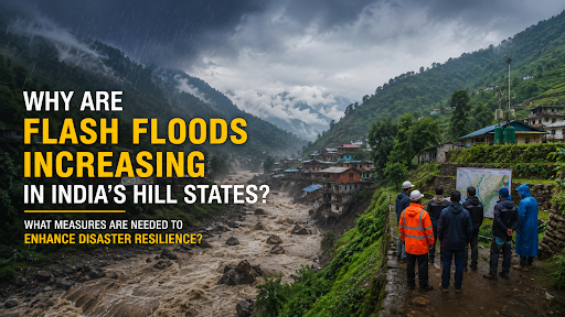
Recent catastrophic cloudbursts over the Beas basin in Himachal Pradesh, intense flash floods in Jammu & Kashmir's Chenab Valley, and devastating landslides in Wayanad, Kerala expose the escalating vulnerability of fragile hill terrains.
What are Flash Floods?
Flash floods are sudden, destructive surges of water occurring within a very short duration, triggered by heavy localized rainfall, cloudbursts, or the sudden failure of natural or artificial barriers like glacial lakes or landslide dams.
Rapid Onset: These events feature an extremely fast rise and recession of water flow, leaving minimal time for preparation.
High Discharge: Despite involving a relatively small volume of water, flash floods generate extremely high discharge rates.
High Devastation: The sudden nature of these floods provides minimal lead time for evacuation, causing exceptionally high damages to life and property.
Why are Hill States Vulnerable to Flash Floods?
Fragile Mountain Ecosystems: The Himalayas constitute geologically young fold mountains (around 50 million years old), resulting in structurally weak, highly unstable slopes naturally prone to mass wasting.Steep Slopes and Rapid Runoff: Extreme elevation gradients characterize mountain terrains, facilitating rapid rainwater runoff and swiftly converting intense precipitation into high-velocity flash floods.
Intense Rainfall and Cloudbursts: Hilly regions routinely experience sudden, highly concentrated heavy rainfall that instantly overwhelms natural drainage capacities.
Landslide-Prone Terrain: Seismic Zones IV and V cover nearly 54% of the Himalayan region, where earthquakes and heavy rains trigger landslides that block river courses, form temporary dams, and unleash massive downstream flash floods upon bursting.
Expanding Human Settlements: Unregulated expansion of human settlements and commercial enterprises into hazard zones, such as river floodplains and steep valleys, restricts natural waterways and escalates flood risks.
What Factors are Increasing Flash Flood Risks in Himalayan States?
Climate Change-Induced Extreme Rainfall: Climate change alters precipitation patterns, concentrating rainfall into shorter, more intense bursts, which drives a 65% rise in extreme rainfall events across the North-West Himalayas. (Source: IMD)
Unplanned Urbanisation: Expansion of concrete infrastructure over natural drainage channels limits soil infiltration and dramatically amplifies surface water runoff.
Road Construction and Slope Destabilisation: Infrastructure mega-projects, such as the Char Dham Pariyojana, employ unscientific vertical hill cutting without prior slope vulnerability analysis, while improper dumping into natural streams obstructs drainage and destabilizes mountain slopes.
Deforestation and Land Use Change: Systematic removal of forest cover strips the soil of its water-holding capacity and accelerates erosion, contributing to a 1.5% decline in Himalayan forest cover between 2001 and 2018. (Source: FAO).
Hydropower and Infrastructure Expansion: Constructing large dams and hydropower projects in fragile zones alters natural river morphometry, while sudden water releases from reservoirs without adequate warning lead times severely exacerbate downstream flooding.
What are the Impacts of Flash Floods in Hill States?
Loss of Human Lives: Sudden flood events cause massive casualties, such as the 2013 Kedarnath tragedy which killed 5,700 people, and the July 2024 Wayanad landslide which claimed over 350 lives.
Damage to Roads and Bridges: High-velocity floodwaters carrying boulders and debris systematically destroy transport infrastructure, washing away roads, bridges, and culverts, which leaves mountain communities completely isolated.
Destruction of Houses and Public Infrastructure: Floodwaters obliterate residential settlements, schools, and hospitals built on floodplains, damaging an estimated 20,141 houses and cowsheds during the 2013 Uttarakhand floods.
Crippling Economic Losses: Disasters impose severe financial burdens, causing an estimated ₹30,000 crore in infrastructure damage across recent Himalayan disasters, with Himachal Pradesh alone suffering ₹10,000 crore in losses in 2023.
Disruption of Tourism and Livelihoods: Destruction of scenic landscapes and transport links paralyzes the tourism sector, forcing 25% of Himalayan villages into permanent out-migration due to livelihood destruction. (Source: ICIMOD)
Frameworks to Address Flash Flood Risks
National Disaster Management Authority (NDMA): Established under the Disaster Management Act, 2005, shifted from a reactive, relief-centric approach to a proactive regime focused on prevention, preparedness, and mitigation.
National Disaster Management Plan: Formulates multi-disaster, technology-driven strategies that dictate Standard Operating Procedures (SOPs) for all phases of the disaster cycle across central and state ministries.
State Disaster Management Authorities (SDMAs): Headed by respective Chief Ministers, SDMAs lay down customized disaster policies at the state level, approve state-specific plans, and mandate the integration of disaster preparedness across diverse government departments.
India Meteorological Department (IMD): Providing meteorological data, weather forecasting, and warnings against severe phenomena like heavy rains, cloudbursts, and cyclones.
National Landslide Risk Management Strategy: Mandates protocols for landslide hazard zonation, slope stabilization techniques, early warning systems, and building regulations in hilly terrains to combat mountain hazards.
Measures to Strengthen Flash Flood Resilience
Improving Early Warning Systems: Deploy Doppler Weather Radars, cloudburst radars, and AI-based flash flood forecasting frameworks to enhance warning lead times and accuracy.
Hazard-Zone Mapping and Land-Use Regulation: Generate a Himalayan Hazard Atlas using seismic, slope, and rainfall data, while strictly enforcing Flood Plain Zoning to prohibit development in vulnerable valleys and riverbeds.
Climate-Resilient Infrastructure Development: Construction of national highways and bridges incorporates adequate waterways (vents and culverts) to prevent drainage obstruction.
Catchment Area Treatment and Afforestation: Implement watershed management through afforestation and check dams to stabilize fragile slopes, retard rapid surface runoff, and minimize river sedimentation.
Community-Based Disaster Preparedness: Empowering local communities as first responders is vital, requiring regular mock drills, youth rescue training, and constructing amenity-equipped elevated flood shelters.
Strengthening Real-Time Weather Monitoring: Integrating Automatic Rain Gauges (ARGs) and satellite-based telemetry across all river sub-basins ensures seamless, real-time data transmission for precise hydro-meteorological forecasting.
Conclusion
Safeguarding fragile hill states requires shifting flash flood management from a reactive relief approach to proactive resilience through integrated technological, ecological, and institutional strategies.
Source: THEHINDU
|
PRACTICE QUESTION Q. "The increasing frequency of flash floods in Himalayan states reflects the growing interaction between climate change and developmental vulnerabilities." Examine. (250 Words, 15 Marks) |
A flash flood is a sudden, highly destructive surge of water characterized by a very fast rise and recession of flow. It possesses a small volume but extremely high discharge, occurring rapidly due to intense localized rainfall, cloudbursts, or the bursting of temporary landslide dams.
Himalayan states feature geologically young and fragile mountains, steep slopes causing rapid water runoff, and high seismic sensitivity. These inherent topographical weaknesses, combined with intense rainfall patterns and frequent landslides, make the region exceptionally prone to devastating flash floods.
Early warning systems, powered by Doppler Weather Radars, AI-based models, and automated telemetry networks, provide critical lead times before a disaster strikes. They enable authorities to execute timely evacuations, safeguard movable assets, and significantly minimize the loss of human lives and property.






© 2026 iasgyan. All right reserved