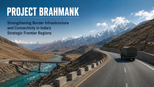
Project Brahmank is a strategic Border Roads Organisation (BRO) initiative aimed at rapidly developing high-altitude, all-weather road infrastructure in Arunachal Pradesh. It counters adversary incursions, enhances military mobilization, and boosts the socio-economic integration of remote frontier communities.
Why In News?
Project Brahmank gains national prominence as India accelerates border infrastructure development in Arunachal Pradesh to counter mounting Chinese incursions.
What is Project Brahmank?
The Border Roads Organisation (BRO) executes this infrastructure initiative to improve connectivity, logistics, and operational readiness across remote eastern border regions.
India defends a 3,488-km-long border with China. Over the last 15 years, the People's Liberation Army (PLA) has intensified activities in the Taksing circle, constructing roads and military camps.
Core Objectives: The project aims to guarantee immediate troop deployments to the Line of Actual Control (LAC), link isolated villages, ensure year-round supply chains, and protect local populations from foreign military harassment.
Key Features
High-Altitude Development: Engineers carve wide, load-bearing roads directly out of steep, fragile Himalayan rock faces.
Advanced Tunneling: Strategic networks bypass treacherous mountain passes and eliminate dangerous hairpin bends.
Disaster-Resilient Engineering: The project implements specialized slope-stabilization techniques to combat landslides and flash floods endemic to the Indian Himalayan Region (IHR).
All-Weather Access: Continuous snow-clearance mechanisms keep strategic lifelines operational throughout extreme winter blockades.
Multi-Modal Synergy: The project aligns with the PM Gati Shakti framework, which recently evaluated 68 major infrastructure projects worth over ₹2.4 lakh crore to ensure intermodal coordination.
Significance
National Security: It fortifies India’s physical presence, neutralizing China’s claims over approximately 90,000 square kilometres of Indian territory.
Tactical Mobility: Rapid road networks slash military travel times, fundamentally altering India’s response capabilities during stand-offs.
Economic Integration: The project integrates frontier villages into the national economy, curbing the outward migration of local populations.
Disaster Response: These "Himalayan Lifelines" facilitate immediate relief and evacuations during extreme weather events
Source: PIB
|
PRACTICE QUESTION Q. With reference to India's border infrastructure and strategic geographic features, consider the following statements: 1. India shares an undemarcated 3,488 km-long border with China. 2. The strategic Taksing area is located in the state of Himachal Pradesh. 3. Project Brahmank is a strategic infrastructure initiative executed by the Border Roads Organisation (BRO). Which of the statements given above is/are correct? A) 1 and 2 only B) 1 and 3 only C) 3 only D) 1, 2, and 3 Answer: B Explanation Statement 1 is correct: India shares a 3,488 km-long border with China. This border is largely undemarcated and is referred to as the Line of Actual Control (LAC) because of differing perceptions of the boundary between the two nations. Statement 2 is incorrect: The strategic Taksing area is located in the Upper Subansiri district of Arunachal Pradesh, not Himachal Pradesh. It is a remote border village near the McMahon Line where reports of Chinese infrastructure development and incursions have surfaced. Statement 3 is correct: Project Brahmank is indeed a strategic infrastructure initiative executed by the Border Roads Organisation (BRO). It focuses on maintaining and developing road connectivity in the Siang and Upper Siang districts of Arunachal Pradesh to support the armed forces and local population. |

© 2026 iasgyan. All right reserved