Source: BRITANNICA
Disclaimer: Copyright infringement not intended.
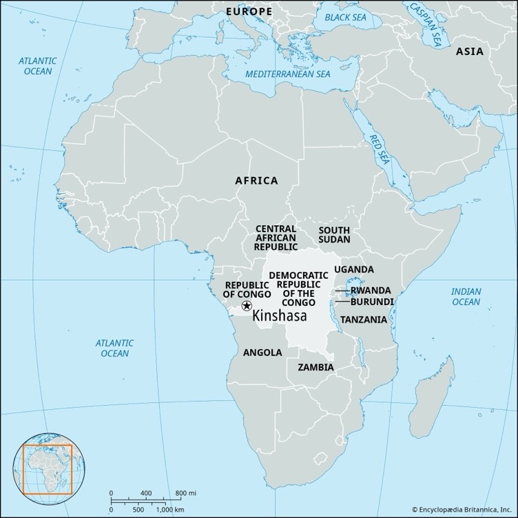
An article in Down To Earth analyses how Kinshasa dual exposure to Congo River backflow & local runoff-driven floods combined with population growth & inadequate urban planning has exacerbated city vulnerability to extreme rainfall events.
Dual Risk Flooding
Riverine Seasonal Congo River flooding (Dec–Jan).
Pluvial/Urban Sudden intense rainfall over Kinshasa sealed urban surfaces causes rapid runoff overwhelming small tributaries like Ndjili & Lukaya.
Backwater Effects High water levels in Congo River slow down tributary discharge causing upstream water rise & overflow.
Runoff Amplification Due to hills in south of Kinshasa & widespread loss of permeable ground rainfall rapidly drains into low-lying, densely populated areas.
Unplanned Urban Expansion From 200k in 1950 to nearly 17.8 million in 2025 a 4.38% annual rise outpacing infrastructure.
Settlement in Floodplains Over 2% of residents live in high-risk areas without formal drainage or regulation.
Infrastructure Gaps
Blocked or absent drainage systems.
Public waste systems dysfunctional worsens stormwater accumulation.
No flood zoning or land-use enforcement.
Impact Assessment
Human Toll At least 70 dead, 150 injured, 21,000+ displaced.
Health Systems: 73 healthcare centers affected disrupting services during health emergencies.
Transport Breakdown Streets turned into rivers; movement only possible via canoes or swimming in many districts.
Inadequate Warning Systems Community-based alerts failed during crisis.
Climate Change Role Increased frequency of short-duration, high-intensity rainfall events expected due to warming — even if annual rainfall totals stay stable.
Lack of Catchment Integration Fragmented management of water systems fails to address full watershed impacts.
Research & Policy Recommendations
Catchment-Based Planning Develop flood management strategies at watershed level linking urban & peri-urban hydrology.
Upgrade Urban Drainage Prioritize investment in engineered stormwater infrastructure.
Define Flood Safety Zones Delineate risk-prone areas with hydro-meteorological data & enforce zoning.
Early Warning Systems Satellite-linked, real-time monitoring for local rainfall events.
Community Engagement Educate citizens on flood risks & response protocols.
Institutional Coordination Congo Basin Water Resources Research Center & Mettelsat must lead technical capacity building with regional/global partners.
|
Parameter |
Kinshasa (Urban Capital) |
Congo Basin (Regional Ecosystem) |
|
Geographic Location |
Southwestern DRC, along south bank of Congo River |
Spans across 9 countries in Central Africa including DRC, Republic of Congo, CAR, Cameroon, Gabon, Equatorial Guinea, Angola, Rwanda & Burundi |
|
Area |
~9,965 km² (urban agglomeration) |
~3.7 million km² (second-largest tropical forest basin globally) |
|
Topography |
Lowland basin with surrounding hills; steep urban slopes toward south & east |
Vast plateau & rainforest with gentle slopes, marshes, swamps & highlands in periphery |
|
Elevation Range |
250–400 meters above sea level |
200 m (central lowlands) to over 1,000 m in outer regions |
|
Hydrological Features |
Ndjili, Lukaya tributaries; main Congo River channel |
Includes entire Congo River system & >15 major tributaries (Ubangi, Kasai, Lualaba, Sangha) |
|
Soil Types |
Lateritic & sandy soils; erosion-prone |
Ferralsols, hydromorphic & alluvial soils; nutrient-poor but deeply weathered |
|
Climate |
Tropical wet & dry (Aw - Köppen); April & Dec are peak rainfall months |
Equatorial climate (Af) in core; sub-equatorial in periphery; year-round rainfall with seasonal peaks |
|
Rainfall |
~1,200–1,600 mm annually; increasingly intense short bursts |
1,500–2,000+ mm annually in interior; 1,000 mm in outer edges |
|
Drainage Density |
Low-to-moderate in built-up core; natural drains blocked |
Extremely dense river network; second in global freshwater discharge after Amazon |
|
Biodiversity Status |
Urban sprawl has severely reduced native flora & fauna |
One of world's most biodiverse regions; home to 400+ mammals, 1,000+ birds, great apes, okapi |
|
Urban Land Use Trends |
Rapid informal settlement, poor waste disposal, no enforced zoning |
Mostly forested but facing deforestation pressures; slash-&-burn & logging |
|
Population (2025 est.) |
~17.78 million (3rd largest African city) |
~150 million people across basin (over 40 million in DRC alone) |
|
Key Environmental Threats |
Urban flooding, pollution, deforestation at urban fringe, soil sealing |
Logging, mining, hydroelectric projects, climate change, agriculture expansion |
|
Flood Types |
Urban pluvial floods, flash floods, riverine backwater effects |
Seasonal floods, riparian inundation, floodplain dynamics, peatland drainage |
|
Flood Risk Governance |
Underfunded, fragmented institutions; weak urban resilience planning |
Cross-border governance via Congo Basin Forest Partnership, COMIFAC, etc. |
|
Scientific Infrastructure |
Congo Basin Water Resources Research Center, METTELSAT |
Regional & international collaborations (e.g., CIFOR, WRI, FAO) |
|
Role in Carbon Cycle |
Urban carbon emitter; deforestation contributes to emissions |
Major global carbon sink (peatlands store over 30 billion tons of carbon) |
|
Strategic Importance |
National capital, political & economic nerve center |
Ecological regulator of rainfall, water, carbon in central Africa & beyond |
|
Transportation |
Overburdened road network; minimal flood-resilient design |
River network crucial for transport; limited land access in basin core |
|
Development Challenges |
Infrastructure lag, flood vulnerability, waste mismanagement |
Balancing conservation with economic development & population needs |
|
Parameter |
Details |
|
Length |
~4,700 km (2nd longest in Africa, after Nile) |
|
Discharge |
~41,000 m³/s (2nd largest in world after Amazon) |
|
Basin Area |
~3.7 million km² |
|
Source |
Highlands of southeastern DRC (Lualaba River is its upper course) |
|
Mouth |
Atlantic Ocean at Banana, DRC |
|
Major Tributaries |
Ubangi, Sangha, Kasai, Lulonga, Aruwimi, Lomami, Luvua, Tshuapa |
|
Key Cities Along River |
Kisangani, Mbandaka, Kinshasa, Brazzaville, Matadi |
|
Navigability |
~3,000 km navigable (including tributaries) |
|
Hydroelectric Potential |
Inga Dam sites: World’s largest untapped hydro potential (~100,000 MW) |
|
Unique Feature |
Only major river to cross equator twice |
|
Biodiversity |
Home to endemic fish, aquatic mammals (e.g., African manatee), Congo peacock |
|
Ecological Role |
Supports world’s 2nd largest rainforest; integral to global carbon cycle |
|
Flood Characteristics |
Seasonal; peak flow Dec–Jan; floodplains & wetlands critical buffer zones |
|
Sediment Transport |
Extremely high load; shapes Atlantic coastal deltas |
|
Cultural Significance |
Lifeline of Central Africa; transport, fisheries & spiritual relevance |
|
Cross-border River |
Flows through or borders 9 countries |
For more such articles, please refer to IAS GYAN
Sources: DOWN TO EARTH
|
PRACTICE QUESTION Q. Urban flooding in African megacities like Kinshasa reveals complex interaction between natural hydrology & unregulated urban growth. Discuss hydrological challenges of Congo River Basin in light of recent flood disasters in Kinshasa. |


© 2026 iasgyan. All right reserved


