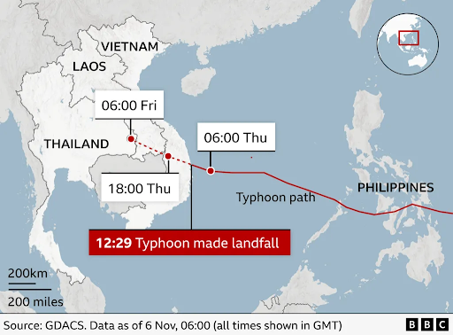
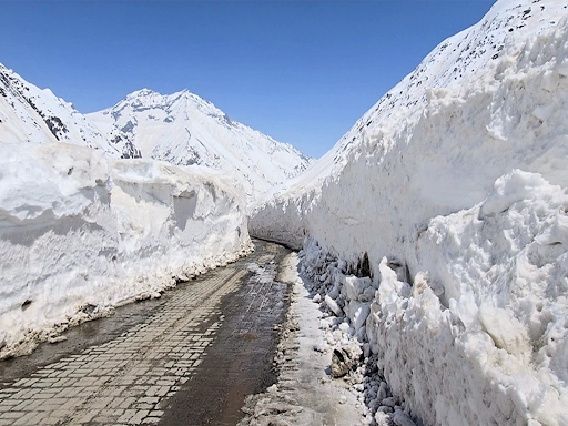
Typhoon Kalmaegi, a Category 3 storm, caused widespread floods and landslides in Cebu, Philippines. This disaster, following recent earthquakes, prompted a national state of calamity, highlighting the Philippines' growing vulnerability to climate-related events.
Copyright infringement not intended
Picture Courtesy: BBC
Typhoon Kalmaegi, a highly destructive natural disaster, hit the Philippines and Vietnam in November 2025.
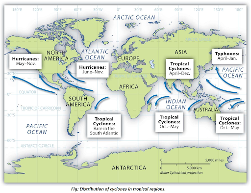
Typhoons are powerful, rotating tropical storms (a type of tropical cyclone) that form in the northwestern Pacific Ocean; around the Philippines, Japan, and China.
Conditions for Formation
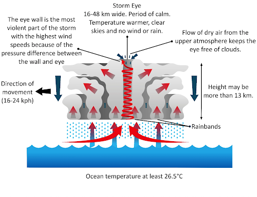
Structure and Characteristics
The Northwest Pacific Basin is the world’s most active cyclone region, generating about 25–30 storms annually.
Countries like the Philippines, Japan, China, Taiwan, and Vietnam face repeated impacts due to their coastal geographies and exposure to warm ocean currents.
The Philippines is the world’s most disaster-prone nation according to the 2024 World Risk Index.
|
Read all about: Cyclone Shakhti in Arabian Sea |
Source: BBC
|
PRACTICE QUESTION Q. What does the 'Eye' of a mature tropical cyclone signify? A)A region of intense thunderstorms and the strongest winds. B) A calm and clear area at the center of the storm with light winds. C) The outermost region of the cyclone with moderate rainfall. D) The area where the storm surge is always at its maximum height. Answer: B Explanation: The 'Eye' is a distinct feature at the center of a strong tropical cyclone. It is a region of mostly calm weather, with light winds and often clear skies. This is because air from the upper levels of the atmosphere sinks in the center of the storm, suppressing cloud formation. |
A cyclone is a large-scale, rapidly rotating storm system characterized by a low-pressure center, strong winds, and a spiral arrangement of thunderstorms that produce heavy rain. The air circulates inward and is deflected by the Earth's rotation (the Coriolis force), resulting in a counter-clockwise rotation in the Northern Hemisphere and a clockwise rotation in the Southern Hemisphere.
Cyclones require warm tropical ocean waters (above 26.5°C) for energy, along with a pre-existing disturbance, high humidity, low vertical wind shear, and sufficient Coriolis force.
Cyclones need the Coriolis force to spin, which is too weak within 5 degrees latitude of the equator.


© 2026 iasgyan. All right reserved