Disclaimer: Copyright infringement not intended.
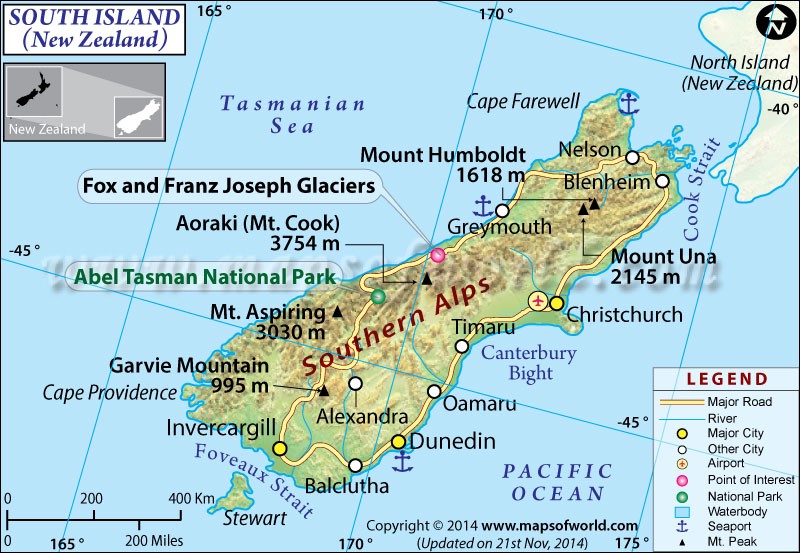
New Zealand experienced 6.7 magnitude earthquake in its seismically active South Island region highlighting country vulnerability due to its location on Pacific Ring of Fire.
|
Feature |
Details |
|
Location |
Southern Hemisphere, part of New Zealand |
|
Geographic Coordinates |
45° S latitude, 169° E longitude |
|
Total Area |
150,437 km² (larger than North Island) |
|
Major Cities |
Christchurch, Dunedin, Invercargill, Nelson, Queenstown |
|
Population |
~1.2 million (as of 2024) |
|
Climate |
Oceanic & temperate with alpine regions experiencing snowfall |
|
Notable Natural Features |
Southern Alps, Fiordland National Park, Aoraki/Mt. Cook |
|
Seismic Activity |
Lies on Alpine Fault prone to earthquakes |
|
Economic Importance |
Agriculture, tourism, viticulture (wine production), hydroelectric power |
|
Notable Earthquakes |
2011 Christchurch earthquake (6.3 magnitude), 2025 South Island earthquake (6.7 magnitude) |
|
Aspect |
Details |
|
Definition |
A horseshoe-shaped belt of intense seismic & volcanic activity surrounding Pacific Ocean |
|
Length |
~40,000 km |
|
Countries Affected |
USA, Canada, Russia, Japan, Philippines, Indonesia, New Zealand, Chile, Peru, Mexico, etc. |
|
Major Tectonic Plates |
Pacific Plate, Indo-Australian Plate, Eurasian Plate, North American Plate, Nazca Plate |
|
Seismic Activity |
81% of world’s largest earthquakes occur in this region |
|
Volcanic Activity |
Contains 75% of world’s active volcanoes (~452 volcanoes) |
|
Notable Disasters |
2004 Indian Ocean tsunami, 2011 Japan earthquake & tsunami, 2023 Turkey-Syria earthquake |
|
New Zealand's Position |
Lies on boundary of Indo-Australian & Pacific plates, prone to earthquakes & tsunamis |
|
Risk Factors |
Frequent subduction zones, tectonic plate collisions, undersea volcanic eruptions |
|
Type of Plate |
Definition |
Examples |
Seismic Activity |
|
Oceanic Plates |
Thin, dense tectonic plates that primarily form ocean floor |
Pacific Plate, Nazca Plate |
High (frequent subduction causes deep-sea earthquakes & tsunamis) |
|
Continental Plates |
Thick, buoyant plates forming landmasses |
North American Plate, Eurasian Plate |
Moderate to High (earthquakes in fault zones, e.g., San Andreas) |
|
Major Tectonic Plates |
Largest plates covering Earth's surface |
Pacific, Eurasian, Indo-Australian, North American, South American, African, Antarctic |
High (major earthquakes occur at plate boundaries) |
|
Minor Tectonic Plates |
Smaller plates between major plates |
Arabian Plate, Caribbean Plate, Philippine Sea Plate |
Variable (depends on proximity to major plate boundaries) |
|
Trench Name |
Location |
Depth (m) |
Tectonic Plates Involved |
Notable Features |
|
Mariana Trench |
Western Pacific Ocean (near Guam) |
10,994 m (Challenger Deep) |
Pacific Plate vs. Philippine Sea Plate |
Deepest trench in world; home to unique deep-sea life |
|
Tonga Trench |
South Pacific Ocean (near Tonga) |
10,882 m |
Pacific Plate vs. Indo-Australian Plate |
One of most seismically active trenches |
|
Philippine Trench |
Philippine Sea |
10,540 m |
Philippine Sea Plate vs. Eurasian Plate |
Known as "Mindanao Trench"; formed by subduction |
|
Kermadec Trench |
South Pacific Ocean (near New Zealand) |
10,047 m |
Pacific Plate vs. Indo-Australian Plate |
Part of Ring of Fire; close to Tonga Trench |
|
Puerto Rico Trench |
North Atlantic Ocean (near Caribbean) |
8,376 m |
North American Plate vs. Caribbean Plate |
Deepest part of Atlantic Ocean; tsunami risk area |
|
Java (Sunda) Trench |
Indian Ocean (off coast of Indonesia) |
7,725 m |
Indo-Australian Plate vs. Eurasian Plate |
Site of 2004 Indian Ocean tsunami |
|
Peru-Chile (Atacama) Trench |
Southeast Pacific Ocean |
8,065 m |
Nazca Plate vs. South American Plate |
Generates massive earthquakes & tsunamis |
|
Kuril-Kamchatka Trench |
Northwest Pacific Ocean |
10,500 m |
Pacific Plate vs. Eurasian Plate |
High earthquake activity; connected to Japan Trench |
|
Japan Trench |
Western Pacific Ocean |
8,000 - 9,000 m |
Pacific Plate vs. North American Plate |
Site of 2011 Tōhoku earthquake & tsunami |
|
Aleutian Trench |
North Pacific Ocean (off Alaska) |
7,679 m |
Pacific Plate vs. North American Plate |
Part of subduction zone responsible for Alaskan earthquakes |
|
Tsunami Warning System |
Region Covered |
Established By |
Key Features |
Notable Events Detected |
|
Pacific Tsunami Warning Center (PTWC) |
Pacific Ocean, Hawaii, U.S. Territories |
U.S. NOAA (National Oceanic & Atmospheric Administration) |
Monitors seismic activity & sea level changes; issues alerts to 28 member countries |
2004 Indian Ocean tsunami, 2011 Japan tsunami |
|
Indian Ocean Tsunami Warning System (IOTWS) |
Indian Ocean (South Asia, Africa, Australia) |
UNESCO-IOC (Intergovernmental Oceanographic Commission) |
Developed after 2004 tsunami; network of deep-sea buoys & tide gauges |
2004 Indian Ocean tsunami, 2012 Banda Aceh earthquake |
|
Japan Meteorological Agency (JMA) Tsunami Warning System |
Japan & surrounding regions |
Japan Meteorological Agency |
Advanced real-time seismic & ocean monitoring; uses GPS buoys |
2011 Tōhoku earthquake & tsunami |
|
U.S. National Tsunami Warning Center (NTWC) |
North America (U.S. & Canada) |
NOAA, U.S. Geological Survey (USGS) |
Focuses on Alaska, West Coast & Atlantic; issues alerts for regional tsunamis |
1964 Alaska tsunami, 2018 Alaska Gulf earthquake |
|
Indonesia Tsunami Early Warning System (InaTEWS) |
Indonesia & nearby regions |
BMKG (Indonesian Meteorology, Climatology & Geophysics Agency) |
Uses seismometers, buoys & coastal sirens |
2004 Indian Ocean tsunami, 2018 Sulawesi tsunami |
|
European-Mediterranean Tsunami Warning System (NEAMTWS) |
Mediterranean, North Atlantic & Black Sea |
UNESCO-IOC |
Covers tsunami-prone coastal European regions |
2003 Algeria tsunami, 2020 Aegean Sea earthquake |
|
South China Sea Tsunami Advisory Center (SCSTAC) |
South China Sea & adjacent areas |
China Earthquake Administration |
Focuses on regional tsunamis; integrates with global systems |
2013 Solomon Islands tsunami |
|
Australia Tsunami Warning System (ATWS) |
Australia & surrounding waters |
Geoscience Australia, Bureau of Meteorology |
Uses deep-ocean buoys, tide gauges & seismic sensors |
2007 Solomon Islands tsunami, 2015 Papua New Guinea tsunami |
|
Chile Tsunami Warning System (SHOA - Hydrographic & Oceanographic Service of Navy) |
Pacific Coast of South America |
Chilean Navy |
Part of Pacific-wide monitoring; integrates with PTWC |
2010 Chile earthquake & tsunami, 2015 Illapel tsunami |
For more information, please visit IAS GYAN
Sources:
|
PRACTICE QUESTION Q. Explain formation of oceanic trenches & their significance in plate tectonics. How do these trenches contribute to earthquake & tsunami generation? |


© 2026 iasgyan. All right reserved


