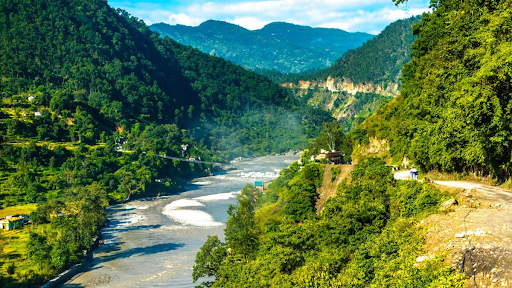
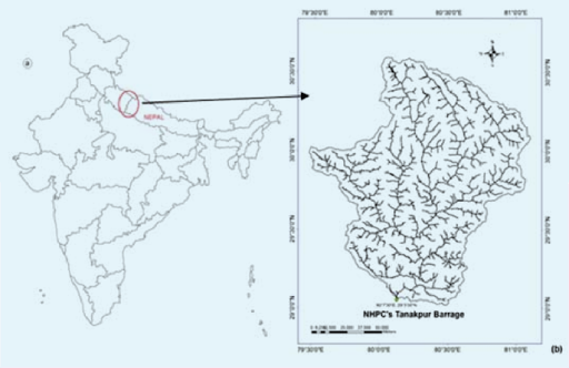
At an elevation of 3,600 m (11,800 ft) in the Pithoragarh district, the Sharda River flows downstream of the Kāli River, also known as the Mahakali River, which starts its journey in the Great Himalayas in the northern Indian state of Uttarakhand, on the eastern slopes of the Nanda Devi massif.
Copyright infringement not intended
Source: Curly Tales
Four teens died after being swept away while bathing in the Sharda River recently.
The Sharda River is the downstream of the Kāli River (or Mahakali River), which originates in the northern Uttarakhand state of India in the Great Himalayas on the eastern slopes of the Nanda Devi massif. It is located in the Pithoragarh district at an elevation of 3,600 m (11,800 ft).
Copyright infringement not intended
Source: Research Gate
Source: TOI
|
Practice Questions Q. Consider the following statements about the Sharda River: The Sharda River is also known as the Mahakali River in Nepal. It forms part of the India-Nepal international boundary. It originates from the Yamunotri glacier in Uttarakhand. The Sharda River merges with the Ghaghara River in Uttar Pradesh. Which of the statements given above are correct? A. 1 and 2 only B. 1, 2 and 4 only C. 2, 3 and 4 only D. 1, 2, 3 and 4 Answer: B. 1, 2 and 4 only Explanation: Statement 1: Correct. The Sharda River is called the Mahakali River in Nepal. Statement 2: Correct. It serves as a boundary river between India and Nepal in some stretches. Statement 3: Incorrect. It originates from the Lipulekh Pass region in the Himalayas, not from the Yamunotri glacier. Statement 4: Correct. It merges with the Ghaghara River in Uttar Pradesh. |


© 2026 iasgyan. All right reserved


