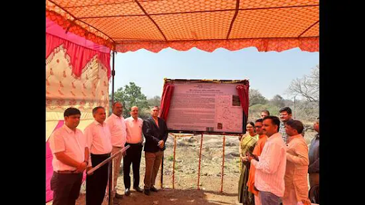
GSI recently declared Kalinjar Fort a National Geo-Heritage Site for its rare 1.3-billion-year geological gap. While this boosts Bundelkhand’s tourism, lack of statutory protection leaves such sites vulnerable. Experts urge passing the Geo-heritage Bill to ensure preservation.
Copyright infringement not intended
Picture Courtesy: HINDUSTANTIMES
The Geological Survey of India (GSI) designated the hill area around the historic Kalinjar Fort in Uttar Pradesh as a National Geo-Heritage Site.
It is located in the Banda district of Uttar Pradesh at an elevation of approximately 1,203 feet on an isolated rocky hill of the Vindhya Range.
Early History: Archaeological evidence suggests its foundations date back to the Gupta period (3rd–5th Century CE).
The Chandela Dynasty (9th–13th Century): The fort reached its zenith under the Chandelas, who made it one of their capitals and a hub of art and culture. They famously used the title Kalanjaradhipati ("Lord of Kalanjara").
Medieval Resistance: It successfully repelled an invasion by Mahmud of Ghazni in 1023 CE.
Sher Shah Suri’s Death (1545): The Afghan ruler Sher Shah Suri died here during a siege when a stray gunpowder explosion mortally wounded him.
Mughal & Maratha Rule: Akbar captured the fort in 1569 and gifted it to Birbal. It later came under the Bundela hero Maharaja Chhatrasal and subsequently the Marathas before being annexed by the British in 1812.
The Seven Gates
The ascent to the fort is guarded by seven distinct gateways—including the Alam Darwaza, Ganesh Darwaza, and Hanuman Darwaza—some reflecting the seven known planets of ancient astronomy.
Art and Carvings
The walls are adorned with intricate stone carvings of deities, animals, and celestial nymphs (apsaras).
Neelkanth Mahadev Temple
This is the fort's holiest site, built by Chandela ruler Paramardi Deva. It houses a blue-stone Shiva Lingam with silver eyes.
Rock-Cut Sculptures
The fort is renowned for its colossal rock-cut carvings, including a 24-foot tall Mahasadashiva (Bhairava) with 18 arms and various incarnations of Vishnu, such as the Varaha.
Water Reservoirs
Strategic water management is evident in reservoirs like Koti-Teertha, which was believed to have healing properties for leprosy.
Geo-Heritage Status
In March 2026, the Geological Survey of India (GSI) declared the hill a National Geo-Heritage Site due to the rare "Eparchaean Unconformity," where 2.5-billion-year-old granite meets 1.2-billion-year-old sandstone.
Source: HINDUSTANTIMES
|
PRACTICE QUESTION Q. Consider the following statements regarding the Kalinjar Fort: 1. It is located in the Vindhya Range in Uttar Pradesh. 2. The fort was primarily built by the Bundela Rajputs. 3. The famous Neelkanth temple is located within the fort complex. Which of the statements given above is/are correct? A. 1 only B. 1 and 3 only C. 2 and 3 only D. 1, 2 and 3 Answer: B Explanation: Statement 1 is correct: Kalinjar Fort is located in the Banda district of Uttar Pradesh. It is strategically situated on an isolated flat-topped hill at the end of the Vindhya Range. Statement 2 is incorrect: While the fort was later held by various dynasties including the Bundelas, it was primarily built by the Chandelas (Chandela Rajputs). The Chandelas are famously associated with its construction and long-term rule before it passed to other powers like the Mughals and Bundelas. Statement 3 is correct: The famous Neelkanth (Mahadev) Temple is indeed located within the fort complex. It was built by the Chandela ruler Paramaditya Dev and is considered a highly sacred site where, according to legend, Lord Shiva rested after consuming poison during the Samudra Manthan. |
The Kalinjar Fort hill is famous for the Eparchaean Unconformity, a rare geological feature showcasing a 1.3-billion-year temporal gap where 2.5-billion-year-old Bundelkhand granite is directly overlaid by 1.2-billion-year-old Kaimur sandstone.
Answer: The Geological Survey of India (GSI) is the nodal agency responsible for identifying, researching, and officially designating National Geo-Heritage Sites across the country.
It is located in the Banda district of Uttar Pradesh, nestled in the Vindhya Mountains, approximately 130 km from Khajuraho. The fort's exact origins are ancient, with some structures dating back to the Gupta dynasty (3rd–5th centuries). It was significantly developed and ruled by the Chandela dynasty between the 9th and 15th centuries.


© 2026 iasgyan. All right reserved