🔔Join APTI PLUS Prelims Mirror 2026 | All India Open Mock Test Series on 12th April, 26th April & 3rd May 2026 |Register Now!
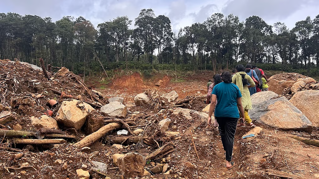
Hurricane Ida
(No copyright infringement intended)
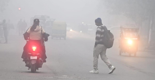
Context
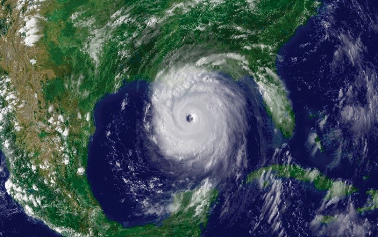
Tropical Storms
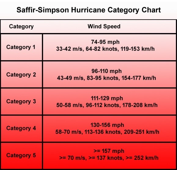
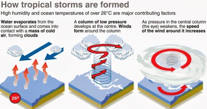
Favorable Conditions required
|
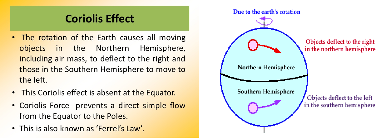
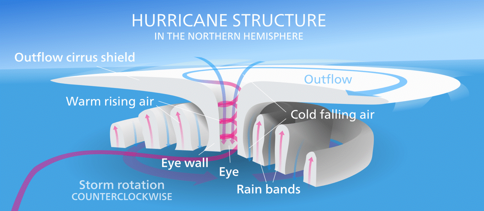
KEY CONCEPTS Coriolis Effect The Coriolis effect is the apparent acceleration of a moving body as a result of the Earth's rotation. It makes things (like planes or currents of air) traveling long distances around the Earth appear to move at a curve as opposed to a straight line. The Coriolis effect is an important determinant of wind direction on a global scale.
Wind shear Wind shear sometimes referred to as wind gradient, occurs when there is a change in the direction or speed of wind usually at short distances. Atmospheric wind shear is normally described as either vertical or horizontal wind shear. Vertical wind shear is a change in wind speed or direction of winds at increasing heights in the atmosphere. Horizontal wind shear is a change in wind speed with change in lateral position for a given altitude. For cyclones to develop, low vertical wind shear is a must. 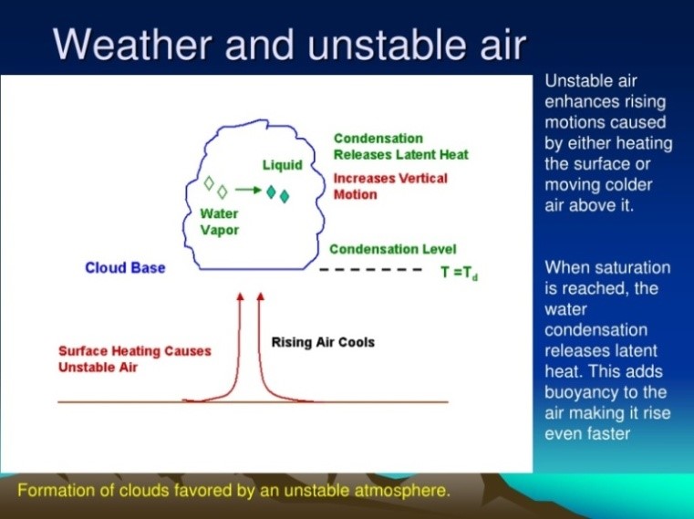 Atmospheric Instability Atmospheric stability determines whether or not air will rise and cause storms; sink and cause clear skies; or essentially do nothing.
Atmospheric instability If an air parcel is warmer than its surrounding environment, then it will be less dense than its surroundings and will rise like a hot air balloon. This is Unstable Air and has the potential for creating thunder storms if it contains enough water vapor.
If an air parcel is cooler than its surrounding environment, then it will be denser than its environment and will sink. Think of this situation as a pebble sinking in water. This is Stable Air which generally leads to clear skies.
If an air parcel is the same temperature as its surrounding environment, then the parcel will not move of its own accord. This is Neutral Air.
|
|
The India Meteorological Department (IMD) is an agency of the Ministry of Earth Sciences. It is the principal agency responsible for meteorological observations, weather forecasting and seismology. IMD is also one of the six Regional Specialised Meteorological Centres of the World Meteorological Organisation. It has the responsibility for forecasting, naming and distribution of warnings for tropical cyclones in the Northern Indian Ocean region, including the Malacca Straits, the Bay of Bengal, the Arabian Sea and the Persian Gulf.
IMD is also one of the six Regional Specialised Meteorological Centres of the World Meteorological Organisation. It has the responsibility for forecasting, naming and distribution of warnings for tropical cyclones in the Northern Indian Ocean region, including the Malacca Straits, the Bay of Bengal, the Arabian Sea and the Persian Gulf.
|
Tropical Cyclone Vs Extra-tropical Cyclone
|
Basis |
Tropical Cyclone |
Extra-tropical Cyclone |
|
Characteristics |
A low-pressure centre, a closed low-level atmospheric circulation, strong winds, and a spiral arrangement of thunderstorms that produce heavy rain. |
A large scale low-pressure weather systems that occur in the middle latitudes of the Earth. |
|
Formation |
It gets intensified over warm tropical oceans and required temperature higher than 27° C, presence of the Coriolis force, small variations in the vertical wind speed, a pre-existing weak low- pressure area or low-level-cyclonic circulation and upper divergent above the sea level system. |
It gets intensified any part of extratropical regions of the Earth (usually between 30° and 60° latitude from the equator), either through cyclogenesis or extratropical transition. |
|
Movement |
It moves from east to west. |
It moves from west to east. |
|
Nature of Cyclone |
Violent storms |
Static, not violent |
|
Type |
Warm Core |
Cold Core |


© 2026 iasgyan. All right reserved