Description
Copyright infringement not intended
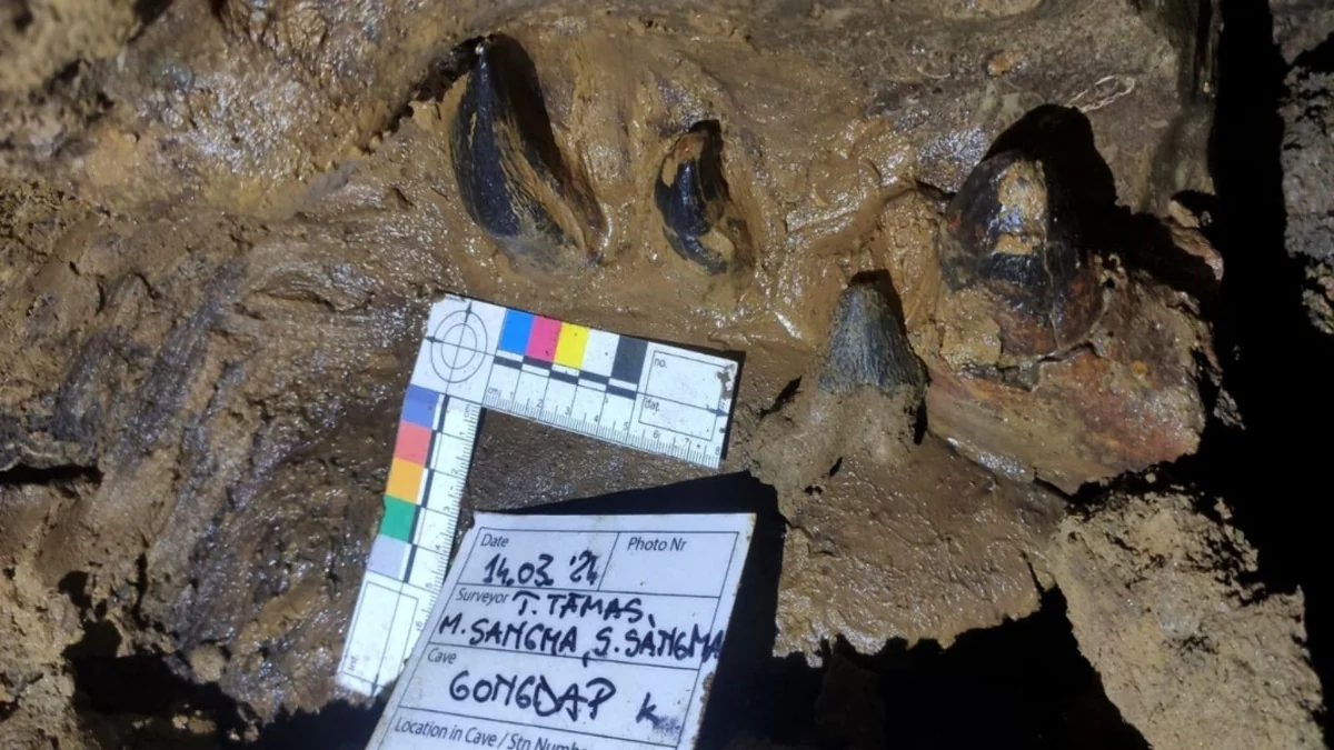
Picture Courtesy: https://www.indiatodayne.in/meghalaya/story/meghalaya-gsi-unearths-40-million-year-old-fossils-in-south-garo-hills-996981-2024-05-02
Context: The Geological Survey of India (GSI) has discovered ancient fossils in Tolegre, South Garo Hills, Meghalaya.
Key Highlights
- The fossils discovered in Gongdap village near Tolegre in Meghalaya's South Garo Hills are estimated to be 35-40 million years old, providing insight into prehistoric life in the region.
- The fossils are believed to originate from extinct species such as Rhodocetus and Amulocetus, which are considered ancestors of modern-day whales. More investigation and research will be required to identify the actual species and their place in evolutionary history.
- The discovery of these fossils is extremely significant for paleontological studies in India since it offers insight into the richness and evolutionary paths of ancient marine life.
About Geological Survey of India (GSI)
- The Geological Survey of India (GSI) is a scientific organization under the Union Ministry of Mines.
- The origins of GSI may be traced back to 1836 when the East India Company established the "Coal Committee" to investigate the supply of coal in eastern India.
- An early surveyor named David Hiram Williams coined the term "Geological Survey of India" in 1847.
- The Geological Survey of India (GSI) was established in 1851 under the direction of Sir Thomas Oldham, who expanded its purpose beyond coal exploration to include geological mapping and rock-type research.

Functions
- The GSI's primary mandate is to provide essential earth science information to the government, industry, and the public.
- It conducts geological surveys, studies, and research to understand India's geological structure, mineral resources, and natural hazards.
- GSI plays a crucial role in supporting key industries like steel, coal, metals, cement, and power by providing geological data and assessments.
- The organization actively participates in international geoscientific forums, contributing to global scientific collaboration and knowledge exchange.
Key Activities
- It conducts comprehensive geological surveys across India to map geological formations, mineral resources, and natural hazards.
- It assesses the mineral potential and availability in different regions of India, supporting mineral exploration and development.
- It is involved in seismological studies, monitoring seismic activity, and providing earthquake-related information and research.
- It uses modern geospatial technologies and geoinformatics for data collection, analysis, and mapping.
- It contributes to capacity building in earth sciences through training programs and workshops.
|
The Geological Survey of India actively engages with international geoscientific organizations and forums, promoting scientific cooperation and knowledge-sharing. It represents India in global discussions on earth sciences, mineral resources, and environmental issues.
|
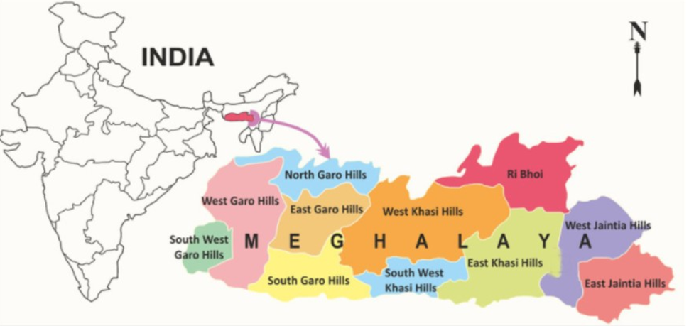
About Garo Hills
- The Garo Hills form the western edge of the Shillong Plateau, rising to elevations of about 4,600 feet.
- The region is drained by numerous tributaries of the Brahmaputra River, contributing to its high rainfall and lush vegetation.
- Garo Hills experiences extremely high rainfall, contributing to its rich biodiversity and forest cover.
- The region is heavily forested, with vegetation including rice paddies, sal trees (genus Shorea), bamboo groves, and lac-producing trees.
- Agriculture is a key economic activity in Garo Hills, with rice cultivation being a primary occupation. Other important products include cotton, bamboo, and lac, contributing to the local economy.
- The region also has significant mineral resources such as coal, limestone, and petroleum, which play a role in the economy.
- The Garo Hills region is inhabited predominantly by the Garo people, who practice a complex matrilineal social system.
- Nokrek National Park, located in the western part of Garo Hills, is home to a diverse range of plant and animal species. In recognition of its biodiversity and conservation value, it Park was designated a biosphere reserve by UNESCO in 2009.
|
Shillong Plateau
●The Shillong Plateau is situated in eastern Meghalaya, forming the highest part of the hill mass that dominates the state.
●It is characterized by rolling terrain and is surrounded by: the Garo Hills to the west, the Khasi Hills to the north, and the Jaintia Hills to the south.
●This plateau is an extension of the peninsular plateau of India, composed primarily of ancient rocks.
●The Shillong Plateau is rich in natural resources, including reserves of coal, iron ore, and limestone. Coal mining and limestone quarrying are important economic activities in the region.
●The Shillong Plateau and its surrounding hills are home to various indigenous communities, including the Khasi, Garo, and Jaintia tribes.
|
Source:
India Today
Wikipedia
Britannica
|
PRACTICE QUESTION
Q. Mountain communities depend on tourism for economic development. However, increased tourism can strain resources and damage fragile ecosystems. How to achieve a sustainable balance between economic growth from tourism and environmental protection in mountain regions.
|


