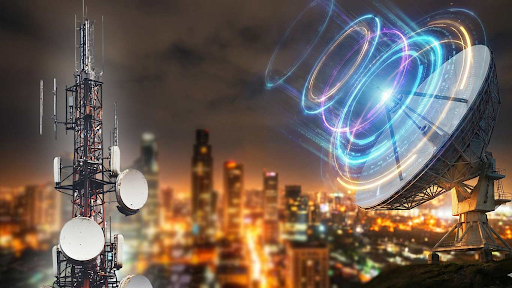


GPS interference, through spoofing or jamming, gravely threatens global transport, causing navigational errors for flights and ships. This deliberate cyber-attack risks collisions, groundings, and traffic chaos. Solutions include alternative navigation systems like INS, VOR, and multi-constellation GNSS (e.g., NavIC), along with enhanced crew training, crucial for mitigating these growing digital threats.

Copyright infringement not intended
Picture Courtesy: INDIAN EXPRESS
Global Positioning System (GPS) interference, including spoofing and jamming, critically threatens global air and maritime navigation.
It is a space-based radionavigation system owned by the United States government and operated by the United States Space Force. It provides location, velocity, and time information to a GPS receiver anywhere on Earth, or near-Earth.
It operates on the principle of trilateration. Satellites orbiting Earth continuously transmit radio signals. A GPS receiver on the ground collects these signals and uses the time difference of arrival from multiple satellites to calculate its precise position.
GPS interference involves purposeful cyber-attacks on GPS signals, designed to disrupt or deceive navigation systems.
GPS Jamming => This involves a device (jammer) emitting strong radio signals on GPS frequencies, which overcome the weaker GPS signals, and effectively blocking them. As a result, GPS receivers cannot determine their location or time.
GPS Spoofing => Spoofing involves a device transmitting false signals on the same frequencies used by GPS satellites. These fabricated signals mislead the GPS receiver into believing incorrect location or timing data. Instead of disrupting the signal entirely, spoofing feeds the receiver misleading information, making it trust inaccurate data.
Aviation Risks => Spoofing can cause pilots to misjudge an aircraft's position, which increase the risk of collisions with terrain or other aircraft.
Maritime Risks => GPS interference can lead to a loss of situational awareness, which disrupts entire maritime operations, affecting trade routes and potentially causing environmental disasters.
Road Transport and Critical Infrastructure => The dependence on GPS for road navigation means spoofing can trigger traffic jams and immobilize transport systems, especially in critical times. Beyond transport, spoofing can cascade into broader systemic failures for critical infrastructure like air traffic control, port operations, and Vessel Traffic Systems (VTS).
Military Implications => GPS interference allows an opponent to disrupt military operations without direct physical confrontation, affecting targeting, reconnaissance, and troop movements.
GPS interference can arise from various sources, not all of which are malicious. These include:
Hotspots for Incidents
Middle East (Persian Gulf, Red Sea) => Amid ongoing conflicts, GPS interference has significantly disrupted maritime navigation. Data from Q1 2025 indicated a 350% rise in spoofing incidents in the Red Sea alone compared to 2024, with some vessels reporting sudden position jumps of hundreds of nautical miles.
Eastern Europe (Russia-Ukraine War) => Incidents are frequently observed in this region due to the ongoing conflict. Airspaces over such war zones are often avoided by civilian aircraft as a preventive measure.
North Korea => South Korea has reported numerous instances of North Korean GPS manipulation affecting dozens of planes and vessels.
For Aircraft
Inertial Navigation Systems (INS) => These are primary backups, using gyroscopes and accelerometers to track an aircraft’s position based on its last known location, independent of external signals.
Ground-Based Radio Navigation: VHF Omnidirectional Range (VOR) and Distance Measuring Equipment (DME) provide reliable ground-based radio navigation, allowing pilots to cross-check their position.
Celestial Navigation/Dead Reckoning => In extreme scenarios, pilots can resort to traditional methods, though these are less common in modern aviation.
Instrument Landing Systems (ILS) => Vital for precision approaches during landing, remains unaffected by GPS spoofing.
Enhanced Crew Training => Aviation authorities like the Directorate General of Civil Aviation (DGCA) emphasize strict crew training to detect and manage GPS interference, encouraging pilots to monitor control room chatter for suspected spoofing.
For Ships
Manual Helm Control and Terrestrial Navigation => During suspected spoofing, ship crews revert to manual steering and use terrestrial navigation methods, such as manual position fixing using land-based aids like lighthouses and radars, to maintain situational awareness.
Multi-Constellation GNSS Systems => Shipping companies are adopting Global Navigation Satellite System (GNSS) receivers that can utilize signals from multiple satellite constellations (e.g., USA’s GPS, Russia’s GLONASS, Europe’s Galileo, China’s BeiDou). This diversification enhances resilience against single-system interference.
eLoran (Enhanced Long Range Aid to Navigation) => Many nations are exploring eLoran, a robust, difficult-to-jam terrestrial navigation system, as a critical backup to satellite navigation. It provides an independent timing and navigation source.
Anti-Jamming Technology => Commercial anti-jamming devices are being developed and deployed, though their effectiveness varies.
Developed by ISRO, NavIC is India's independent regional navigation satellite system. It provides precise positioning and timing services across India and up to 1,500 km beyond its borders.
The need for NavIC became apparent after incidents like India's denial of American GPS access during the 1999 Kargil war and instances of US GPS shutdowns affecting BrahMos missile trials. NavIC's resilience was notably tested during Operation Sindhoor.
NavIC is being integrated into various platforms, including smartphones, to reduce reliance on foreign GPS systems and enhance navigational security.
Source:
|
PRACTICE QUESTION Q. Which of the following atmospheric layers is primarily responsible for the largest source of GPS signal delay and is challenging to model accurately for single-frequency receivers? A) Stratosphere B) Ozonosphere C) Mesosphere D) Ionosphere Answer: D Explanation: The Ionosphere is a layer of charged particles in the Earth's upper atmosphere (from about 80 km to 1000 km altitude). As GPS radio signals pass through the ionosphere, their speed decreases due to interaction with free electrons, causing a delay. This delay is frequency-dependent and highly variable, influenced by solar activity, time of day, season, and location. It is the single largest source of error for single-frequency GPS receivers. |


© 2026 iasgyan. All right reserved