SINAI PENINSULA
17th October, 2023
Geography
Disclaimer: Copyright infringement not intended.
Context
- Hundreds of tonnes of aid from several countries have been waiting in Egypt's Sinai Peninsula for days pending a deal for its safe delivery to Gaza and the evacuation of some foreign passport holders through the Rafah crossing.
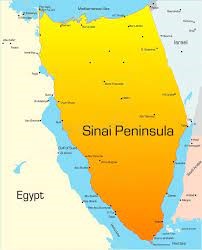
About Sinai Peninsula
- It is a triangle-shaped peninsula in Egypt's northeastern desert.
- It connects Asia and Africa via a land bridge.
- 61,000 square kilometers (23,500 square miles).
- It is Egypt's sovereign territory.
- Boundaries: The Mediterranean Sea borders the peninsula to the north, and Israel and the Gaza Strip border it to the east.
- The Suez Canal, which connects the African and Mediterranean halves of Egypt, is located to the west of the Sinai Peninsula.
- The Sinai Peninsula is bounded to the southwest by the Gulf of Suez and to the south by the Red Sea.
- In the southeast, the Gulf of Aqaba borders Sinai.
- Egypt shares maritime borders with Jordan and Saudi Arabia in the Sinai.
History of Sinai Peninsula
- Egypt, including the Sinai Peninsula, became a member of the British Empire in the late nineteenth century.
- Egypt was ruled by the British until 1922, when it gained independence.
- During the Six-Day War in June 1967, Israeli forces conquered the peninsula.
- It was returned to Egypt in 1982 following the provisions of the 1979 peace deal between the two countries.
- It has a diversified landscape that includes mountain ranges, deserts, plateaus, and coastal regions.
- The Sinai is lightly inhabited; approximately 600,000 people reside there.
- Today, most Sinai residents are Arab Egyptians and Bedouins.
PRACTICE QUESTION Q. Consider the following statements in relation to the Sinai Peninsula.
Which of the following assertions is/are correct?
Answer: B |