Floating LiDAR Buoy marks a milestone for India’s 30 GW offshore wind goal. By providing precise data via Optical Remote Sensing, it boosts "Aatmanirbhar" energy security, cyclone forecasting, and maritime safety while reducing costly technology imports
Copyright infringement not intended
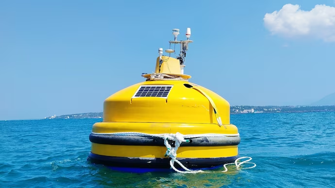
Picture Courtesy: INDIATODAY
Why In News?
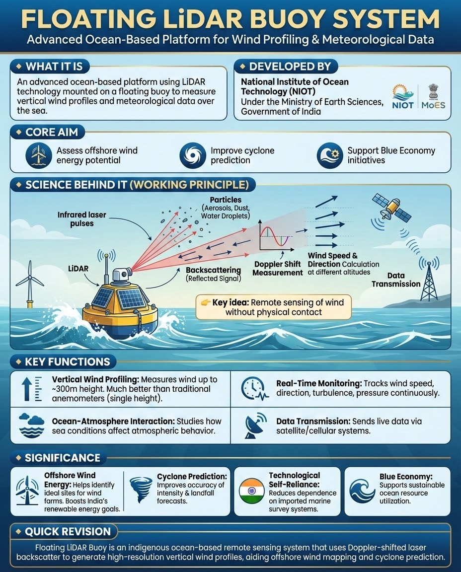
The National Institute of Ocean Technology (NIOT), an autonomous body under the Ministry of Earth Sciences, has tested an indigenous Floating LiDAR (Light Detection and Ranging) Buoy System.
What is a Floating LiDAR Buoy?
It is a remote sensing offshore instrument mounted on a floating buoy that measures wind speed and direction at heights where modern wind turbine blades operate.
The Technology (LiDAR): Unlike Radar which uses radio waves, LiDAR uses pulsed laser light.
The "Floating" Innovation: Traditionally, offshore wind was measured using "Met Masts"—massive fixed towers built into the seabed.
|
Met Masts vs Floating LiDAR |
||
|
|
Fixed Met Mast |
Floating LiDAR Buoy |
|
Cost |
Very High (Construction + Installation) |
Significantly Lower (Modular) |
|
Deployment Time |
Months to Years |
Weeks |
|
Depth Limit |
Shallow Waters (<30m-40m) |
Deep Waters (>100m) |
|
Mobility |
Permanent |
Relocatable (Source: NIOT Analysis) |
Key Technical Features
Vertical Profiling: The system can measure wind parameters at various heights, up to 300 meters above sea level.
Motion Compensation: Since the buoy bobs on waves, it uses advanced sensors (IMUs) and algorithms to subtract the buoy's movement (pitch, roll, heave) from the wind data to ensure accuracy.
Self-Sustaining: The system is powered by integrated solar panels and small wind turbines, allowing it to operate autonomously in the open ocean for long durations.
Strategic Significance for India
Cost-Effective Wind Assessment: India has identified huge offshore wind potential off the coasts of Gujarat and Tamil Nadu (estimated at 71 GW). (Source: National Institute of Wind Energy)
Deep Water Capabilities
Unlike fixed masts, these buoys can be deployed in waters deeper than 50 meters, where India's best wind resources are located.
Cyclone & Weather Forecasting
By providing real-time data from the deep sea, these buoys help the India Meteorological Department (IMD) improve the accuracy of cyclone intensity and landfall predictions.
Conclusion
The development of the Floating LiDAR system aligns with the "Atmanirbhar Bharat" initiative and the "Blue Economy Policy". It transforms India from a technology importer to a potential exporter of maritime sensors, while fueling offshore wind energy goals.
Source: INDIATODAY
|
PRACTICE QUESTION Q. Consider the following statements regarding the 'Floating LiDAR Buoy System' recently tested by the National Institute of Ocean Technology (NIOT): 1. It calculates wind speed and direction by measuring the Doppler Shift in backscattered light. 2. It cannot be deployed in deep waters beyond 50 meters due to severe wave distortion. Which of the statements given above is/are correct? (a) 1 only (b) 2 only (c) Both 1 and 2 (d) Neither 1 nor 2 Answer: A Explanation: Statement 1 is correct: The LiDAR (Light Detection and Ranging) system emits pulsed laser beams into the atmosphere. It calculates wind speed and direction by measuring the Doppler Shift in the light backscattered from moving airborne particles (aerosols), which move at the same speed as the wind. Statement 2 is incorrect: One of the primary advantages of a Floating LiDAR system is its ability to be deployed in deep waters (beyond 50-100 meters) where building fixed meteorological masts (Met Masts) is technically difficult or prohibitively expensive. The system uses advanced motion-compensation algorithms to correct for wave distortion (pitch, roll, and heave), ensuring accurate data even in rough sea conditions. |
A Floating LiDAR (Light Detection and Ranging) Buoy System is an advanced marine technology that utilizes Optical Remote Sensing and infrared laser pulses to capture high-resolution wind data up to 300 meters above sea level. India recently tested its first indigenously developed buoy by NIOT.
Beyond tracking wind for energy purposes, the buoys transmit real-time atmospheric pressure and ocean-atmosphere interaction data. This helps the India Meteorological Department (IMD) significantly improve the predictive accuracy of cyclone intensifications and exact landfall locations.
India has set an ambitious target to achieve 30 Gigawatts (GW) of offshore wind energy capacity by the year 2030, which will play a critical role in the country's broader goal of reaching 500 GW of non-fossil fuel capacity.


© 2026 iasgyan. All right reserved