ISRO uses satellite data to forecast wheat production in India, providing real-time updates on crop conditions. For the 2024-25 Rabi season, ISRO predicts 122.724 million tonnes of wheat. Their technology, including the CROP system, tracks growth across eight major wheat-growing states, improving efficiency and helping with policy decisions.
Copyright infringement not intended
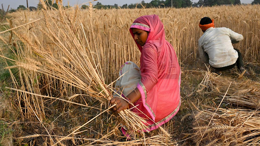
Picture Courtesy: THE HINDU
Indian Space Research Organisation (ISRO) uses satellite data to forecast wheat production accurately.
ISRO’s satellites monitor crops in real time, providing accurate data on wheat growth across eight major wheat-growing states. As of March 31, 2025, ISRO predicts India will produce 122.724 million tonnes of wheat during the 2024-25 Rabi season (winter crop season).
India is the world’s second largest wheat producer (China at top). Wheat is a staple food for millions, especially in northern states like Punjab, Haryana, and Uttar Pradesh.
Accurate predictions help the government:
ISRO’s satellite technology makes these predictions faster and more reliable than traditional methods, which depend on manual surveys. This saves time and boosts efficiency.
ISRO uses a system called CROP (Comprehensive Remote Sensing Observation on Crop Progress). This is a smart tool developed by ISRO’s National Remote Sensing Centre (NRSC).
How does it work?
Satellites Watch the Fields: ISRO’s satellites, like EOS-04, EOS-06, and Resourcesat-2A, orbit Earth and take pictures of wheat fields. These satellites use special cameras (Optical and Synthetic Aperture Radar) to see crops clearly, even through clouds or at night.
Tracking Growth: The satellites check how much wheat is planted and how healthy the crops are. They monitor the fields throughout the Rabi season (October to April).
Data Analysis: The CROP system processes satellite images to estimate the total wheat production. It looks at the area covered by wheat and the condition of the plants.
Real-Time Updates: Unlike old methods that take months, ISRO’s system gives updates almost instantly. This helps farmers and policymakers act quickly if something goes wrong.
For the 2024-25 season, ISRO’s satellites focused on eight states: Punjab, Haryana, Uttar Pradesh, Madhya Pradesh, Rajasthan, Bihar, Gujarat, and Maharashtra. These states grow most of India’s wheat. The prediction of 122.724 million tonnes is a big number, showing India’s strong wheat output.
|
ISRO Supports Agriculture
ISRO’s INSAT-3D satellite also predicts lightning, which helps farmers protect crops during storms. This shows how ISRO’s technology goes beyond wheat to support all kinds of farming. |
Must Read Articles:
Biomass mission - About ESA's Satellite To Monitor Forests
Controversy Over Satellite Data in Tracking Stubble Burning
Source:
|
PRACTICE QUESTION Q. "The Green Revolution transformed Indian agriculture but also led to regional disparities." Critically analyze. 150 words |


© 2026 iasgyan. All right reserved