Technical failures in atomic clocks and satellite losses have reduced NavIC's operational capacity to three satellites. This bottleneck challenges India's strategic autonomy, yet the system remains vital for disaster management, maritime safety, and regional self-reliance in navigation.
Copyright infringement not intended
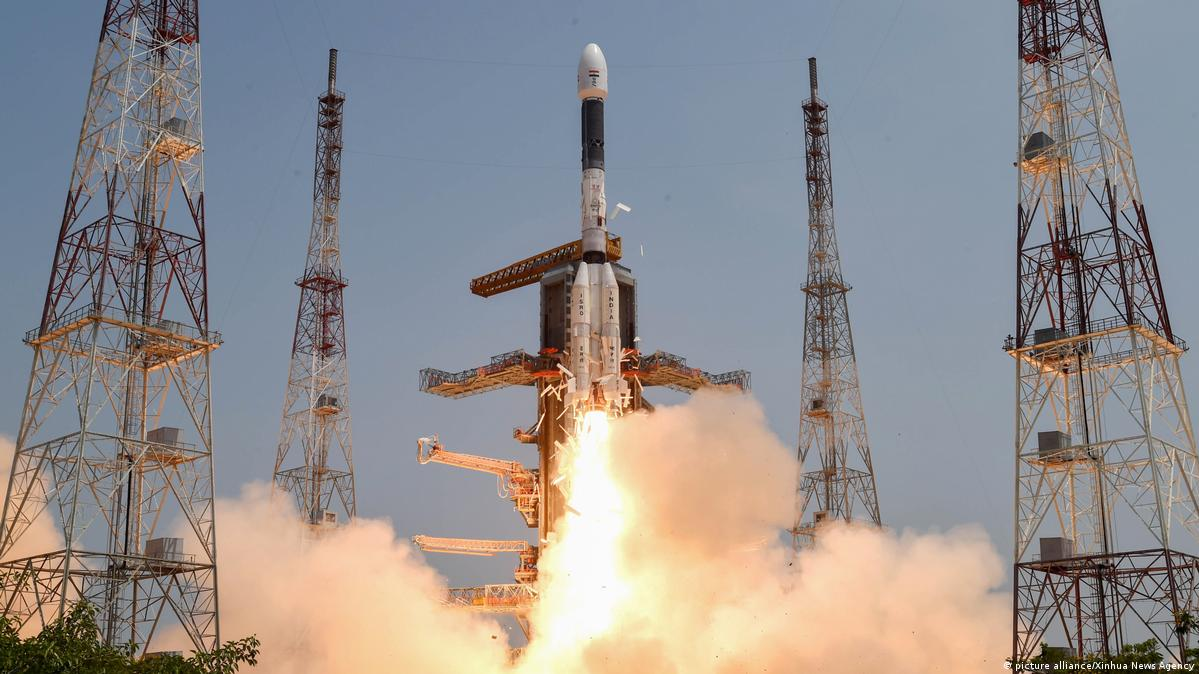
Picture Courtesy: INDIANEXPRESS
Context
India's indigenous navigation system, NavIC (Navigation with Indian Constellation), is facing operational challenges following recent satellite failures.
|
Read all about: NavIC, India's Indigenous System l NavIC, India's Indigenous System |
What is NavIC?
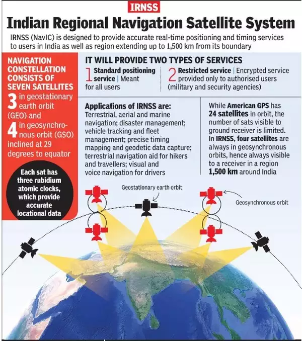
NavIC (Navigation with Indian Constellation) is India’s autonomous, regional satellite navigation system designed and developed by the Indian Space Research Organisation (ISRO).
Originally approved in 2006 as the Indian Regional Navigation Satellite System (IRNSS), it was renamed NavIC in 2016.
Key Features and Technical Architecture
Coverage Area: It provides precise positioning services over India and up to 1,500 km beyond its borders (Primary Service Area). There are future plans to expand this to a global scale.
Satellite Constellation: The first-generation system was designed with 7 satellites—3 in Geostationary Orbit (GEO) and 4 in inclined Geosynchronous Orbit (GSO).
Dual-Frequency Bands: Unlike GPS, which uses the L-band, NavIC utilizes dual frequencies (L5 and S bands). This allows the system to correct atmospheric errors more accurately.
Precision: It offers a position accuracy of better than 20 metres in its service area and can reach up to 5 metres for some users with the right equipment.
Services Offered
NavIC provides two primary levels of service to cater to different user groups:
Major Applications
Recent Setbacks
Launch Failure: The NVS-02 satellite failed to enter orbit in January 2025 due to an electrical malfunction.
Hardware Failure: In March 2026, the onboard atomic clock of the IRNSS-1F satellite failed, rendering it incapable of providing positioning data.
Operational Deficit: Due to the failures, only three satellites in the constellation (IRNSS-1B, IRNSS-1I, and NVS-01) are currently fully functional for providing Positioning, Navigation, and Timing (PNT) services.
Source: INDIANEXPRESS
|
PRACTICE QUESTION Q. With reference to global navigation satellite systems, which of the following pairs are correctly matched? 1. NavIC - India 2. BeiDou - Japan 3. Galileo - European Union 4. GLONASS - Russia Select the correct answer using the code given below: a) 1, 2, and 3 only b) 1, 3, and 4 only c) 2, 3, and 4 only d) 1, 2, 3, and 4 Answer: b Explanation: BeiDou is China's global navigation satellite system, not Japan's (Japan operates QZSS). NavIC is Indian, Galileo is European, and GLONASS is Russian. |
NavIC (Navigation with Indian Constellation), previously known as IRNSS, is India's indigenous regional satellite navigation system. Designed by ISRO, it provides highly accurate positioning and timing services over the Indian landmass and a region extending 1,500 km around its borders.
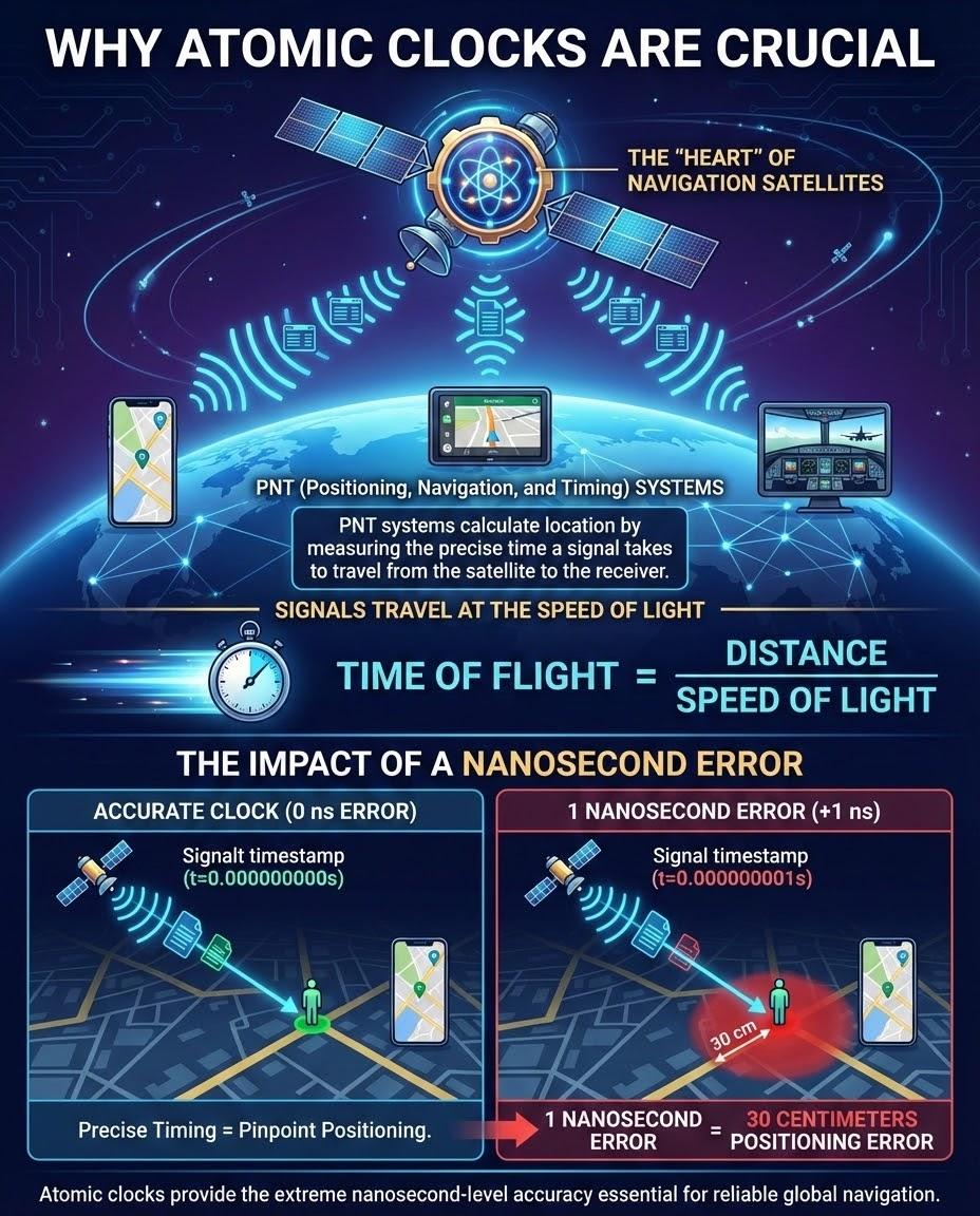
The IRNSS-1F satellite experienced a critical hardware failure when its onboard imported rubidium atomic clock stopped working. Without a functioning atomic clock, the satellite cannot calculate the precise timing required to provide accurate positioning data to users on Earth.
Navigation systems determine a user's location by calculating how long it takes for a signal to travel from the satellite to a receiver. Because these signals travel at the speed of light, a timekeeping error of just one nanosecond results in a 30-centimeter error in the user's location. Atomic clocks provide the extreme precision needed to prevent these errors.


© 2026 iasgyan. All right reserved