Source: TOI
Disclaimer: Copyright infringement not intended.
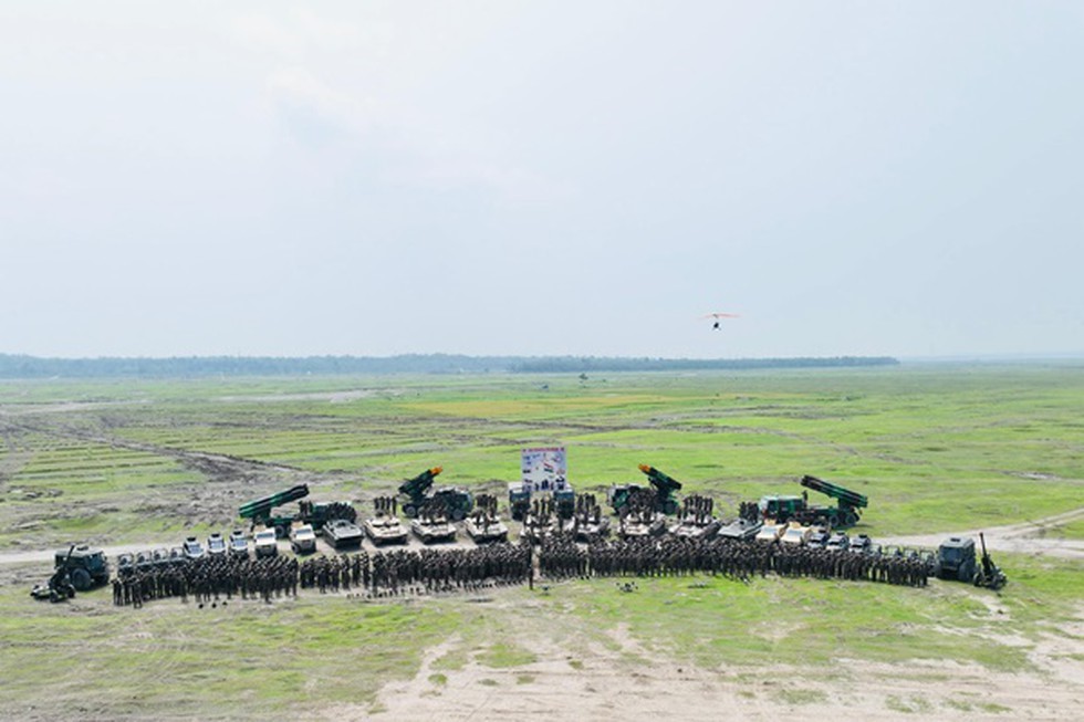
The Indian Army recently conducted a large-scale integrated field training exercise named Exercise Teesta Prahar at the Teesta Field Firing Range in West Bengal close to the strategically significant Siliguri Corridor.
Integrated Participation
Included combat arms (Infantry, Armoured, Artillery) and support arms (Engineers, Signals, Army Aviation).
Para Special Forces and Mechanised Infantry played a significant role in tactical drills.
Modernisation in Action
Showcased next-generation weapon systems and newly inducted military platforms.
Tested advanced battlefield technologies including surveillance, communication and precision targeting.
Realistic Terrain Simulation
Conducted in riverine terrain mimicking real combat conditions.
Featured battle rehearsals, adaptive manoeuvres and dynamic scenario simulations.
Jointness and Synergy
Emphasis on joint operations, inter-operability and seamless coordination among various units and arms.
Demonstrated the Army's ability to conduct operations under adverse weather and terrain conditions.
|
Aspect |
Details |
|
Origin |
Tso Lhamo Lake, Sikkim (Eastern Himalayas, India) |
|
Length |
Approximately 414 km |
|
Flow Path |
India (Sikkim, West Bengal) and Bangladesh |
|
Tributaries |
Rangeet River (major tributary), Lachung Chu, and Lachen Chu |
|
Confluence |
Joins the Brahmaputra River (known as Jamuna in Bangladesh) near Fulchhari |
|
Major Cities/Towns |
Gangtok, Kalimpong, Jalpaiguri, Rangpo, Melli |
|
Hydropower Projects |
Teesta Stage I to VI (multiple projects in Sikkim and West Bengal) |
|
Geopolitical Importance |
Key water-sharing issue between India and Bangladesh |
|
Ecological Significance |
Supports rich biodiversity, agricultural livelihoods, and riverine ecosystems |
|
Disputes/Concerns |
India-Bangladesh water-sharing treaty (pending), frequent flash floods |
|
Aspect |
Details |
|
Alternative Name |
Siliguri Corridor |
|
Location |
West Bengal |
|
Width |
Approximately 20–25 km wide |
|
Length |
Around 200 km |
|
Connects |
Indian mainland with its 8 northeastern states |
|
Boundaries |
Bordered by Nepal (west), Bhutan (north), Bangladesh (south) |
|
Strategic Importance |
Only land route linking NE India with rest of the country; vital for military logistics |
|
Vulnerabilities |
Highly sensitive to military blockades or disruption in case of conflict |
|
Nearby Military Concerns |
Close to Doklam plateau (India-China-Bhutan tri-junction) |
Sources:
|
PRACTICE QUESTION Q. Discuss the importance of integrated military exercises such as Exercise Teesta Prahar in enhancing India’s operational preparedness and strategic deterrence. 250 words |

© 2026 iasgyan. All right reserved