National Highways Authority of India launched the NH-GCI with National Remote Sensing Centre under Indian Space Research Organisation to track highway vegetation via satellites. The index enables targeted greening, improves sapling survival, creates carbon sinks, supports biodiversity, and helps India meet its Paris Agreement climate commitments.
Copyright infringement not intended
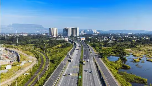
Picture Courtesy: PIB
Context
The National Highways Authority of India (NHAI) has launched the first-ever National Highways Green Cover Index (NH-GCI) to scientifically monitor and manage vegetation along National Highways.
What is the NH-GCI?
It is a quantitative framework designed to assess the green cover along highway corridors, developed by NHAI in collaboration with the Indian Space Research Organisation’s (ISRO) National Remote Sensing Centre (NRSC).
Methodology: It uses high-resolution satellite imagery to measure chlorophyll content, estimating the percentage of green cover within the highway's Right of Way (RoW) for every one-kilometre stretch.
Scope of First Assessment: The inaugural assessment (July-December 2024) covered approximately 30,000 kilometres of National Highways across 24 states.
Key Objectives
Significance
Scientific Monitoring: Replaces inconsistent manual surveys with unbiased, periodic satellite data for precise identification of intervention areas.
Accountability and Transparency: Objectively measures plantation agencies' and contractors' performance with a quantifiable index, supporting NHAI's transparency goal.
Informed Decision-Making: Authorities can use the green cover scores to allocate resources effectively, focusing on highway sections with lower scores.

What are the Potential Challenges?
Survival Rate of Saplings: Ensuring the survival of planted saplings in diverse climatic zones is a critical challenge, moving beyond the mere act of planting
Effective Fund Utilization: Past experiences, such as audits of CAMPA funds, have highlighted issues of mismanagement and low plantation survival rates, offering lessons for highway greening projects.
Way Forward
To maximize the impact of the NH-GCI, the following steps are crucial for creating a truly holistic and sustainable green highway network.
Learn from Global Best Practices
Germany's Green Bridges: Construction of wide, vegetated overpasses ("eco-ducts") over highways to maintain ecosystem connectivity and allow safe wildlife crossing.
USA's Pollinator-Friendly Roadsides: The Federal Highway Administration (FHWA) promotes planting native grasses and wildflowers along roadsides to create habitats for essential pollinators like bees and butterflies.
Conclusion
The National Highways Green Cover Index is a technology-driven environmental governance framework. It ensures a scientific, transparent, and accountable approach for a sustainable, resilient national highway network, supporting climate goals and improving public welfare.
Source: PIB
|
PRACTICE QUESTION Q. Consider the following statements regarding the "National Highways Green Cover Index (NH-GCI)" released in 2026:
Which of the statements given above is/are correct? A) 1 and 2 only B) 2 and 3 only C) 1 and 3 only D) 1, 2 and 3 Answer: D Explanation: Statement 1 is correct: The index was developed by the National Highways Authority of India (NHAI) in collaboration with the National Remote Sensing Centre (NRSC) of ISRO. Statement 2 is correct: The primary objective of the NH-GCI is to provide a quantitative assessment of green cover and plantations specifically within the Right of Way (RoW) of National Highways. It utilizes satellite imagery to provide a macro-level estimation of vegetation presence. Statement 3 is correct: The methodology for measuring green cover involves using high-resolution satellite sensors to detect chlorophyll content. This technology allows for an objective measurement of vegetation health and presence at a granular level of one kilometer. |
The NH-GCI is a scientific framework developed by the NHAI to measure and monitor the percentage of green cover along India's National Highways using high-resolution satellite imagery. It provides a quantitative score for every one-kilometre stretch of highway.
It uses satellite imagery to detect chlorophyll content in the vegetation within the highway's Right of Way (RoW). This data provides an objective and periodic assessment of the green cover, replacing less reliable manual surveys.
The Green Highways (Plantation, Transplantation, Beautification & Maintenance) Policy, 2015, is the foundational policy that guides the development of green corridors in India. It mandates setting aside 1% of the total project cost for highway plantation and its maintenance, and the NH-GCI acts as a tool to monitor the effectiveness of this policy.


© 2026 iasgyan. All right reserved