Disclaimer: Copyright infringement not intended.
Context
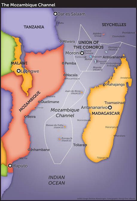
About Madagascar
Landforms of Madagascar
|
PRACTICE QUESTION Examine the historical evolution and contemporary dynamics of India's diplomatic relations with Madagascar. Highlight the key areas of cooperation and challenges in the bilateral relationship. |


© 2026 iasgyan. All right reserved


