IAS Gyan

Daily News Analysis

LiDAR technique

8th December, 2020 Science and Technology

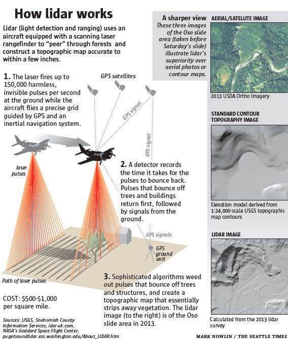
Context: National High Speed Rail Corporation Limited will be adopting Light Detection and Ranging Survey (LiDAR) technique using Laser enabled equipment mounted on a Helicopter for conducting ground survey forthe preparation of Detailed Project Report for the proposed Delhi-Varanasi HSR corridor.

  • The alignment or ground survey is a crucial activity for any linear infrastructure project as the survey provides accurate details of areas around the alignment.

LiDAR technique

  • This technique uses a combination of Laser data, GPS data, flight parameters and actual photographs to give accurate survey data.
  • Based on the findings of the survey, designing of the vertical & horizontal alignment, structures, location of the stations and depots, Land requirement for the corridor, identification of project affected plots/structures, Right of Way etc are decided.
  • The aerial LiDAR survey technique, for the first time for any railway project in India, was adopted for the Mumbai- Ahmedabad High Speed Rail Corridor primarily because of its high accuracy.
  • The ground survey using aerial LiDAR takes only 12 weeks against the 10-12 months if had been done through traditional survey methods.

https://www.pib.gov.in/PressReleasePage.aspx?PRID=1678878