Description
Disclaimer: Copyright infringement not intended.
Context
In a post referring to his visit to the Union Territory earlier this week, the Prime Minister spoke about “the stunning beauty of its islands”, adding that “for those who wish to embrace the adventurer in them, Lakshadweep has to be on your list.”
About Lakshadweep Islands
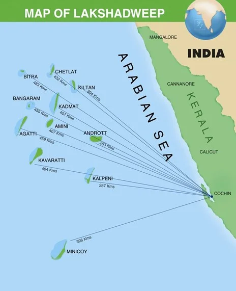
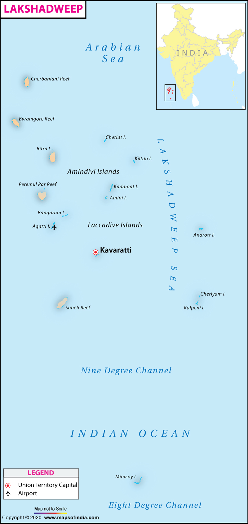
- Lakshadweep is a tropical archipelago comprising 36 atolls and coral reefs situated in the Laccadive Sea, positioned 280 km to 480 km off the Kerala coast.
- Among these, 11 are inhabited, but the current count is 35 islands due to the submersion of Parali 1 because of sea erosion.
- The name Lakshadweep, meaning "one lakh islands" in Malayalam, the official and widely spoken native language in the territory, reflects its origin.
- Fishing stands as the predominant industry.
- As the smallest union territory of India, the islands collectively cover a surface area of merely 32 square kilometers.
- Kavaratti functions as the capital of this uni-district Union Territory, falling under the jurisdiction of the Kerala High Court.
- The primary languages spoken in Lakshadweep include Malayalam, Jeseri (Dweep Bhasha), and Mahl.
- Previously recognized as Laccadive, Minicoy, and Amindivi Islands, the name Lakshadweep was officially adopted on November 1, 1973.
Historical Background
- There has been the existence of human settlements in the region since around 1500 BCE.
- The islands were also mentioned in the Buddhist Jataka stories of the sixth century BCE.
- Islam was established in the region when Muslims arrived around the seventh century.
- During the medieval period, the region was ruled by the Chera dynasty, the Chola dynasty, and finally the Kingdom of Kannur.
- The Catholic Portuguese arrived around 1498 but were expelled by 1545.
- The region was then ruled by the Muslim house of Arakkal, who were vassals to the Kings of Kannur, followed by Tipu Sultan.
- On his death in 1799, most of the region passed on to the British, and with their departure, the Union Territory was formed in 1956.
Geography
- The island is situated in the Laccadive Sea extending between 8 degree N and 12 degree N latitude.
- The entire Lakshadweep islands group is made up of coral deposits.
- The islands consist of unconsolidated pebbles, shingles, cobbles, and boulders. All are atolls surrounded by Fringing Reefs.
- These islands are a part of Reunion Hotspot volcanism.
- Some islands under the Lakshadweep Islands group are:
- Kavaratti ,Agatti ,Minicoy, Amindivi ,Androth,Kalpeni,Pitti ,Suheli Par ,Keltan, Chetlat, Kadmat, Bitra Perumul Par, Bangaram
- Amindivi Islands are the northern-most while the Minicoy island is the
- 8 Degree Channel ( 8 degrees north latitude) separates the islands of Minicoy and Maldives.
- 9 Degree Channel ( 9 degrees north latitude) separates the island of Minicoy from the main Lakshadweep archipelago.
- Largest island: Minicoy Island (south of the nine-degree channel)
- The topography of the Lakshadweep Islands is flat and relief features such as hills, streams, valleys, etc. are absent.
- The Islands are extremely vulnerable to sea-level change as they do not rise more than five meters above sea level.
|
PRACTICE QUESTION
The largest Union Territory of India is?
A) Chandigarh
B) Puducherry
C) Andaman and Nicobar Island
D) Lakshdweep
Answer: C
|


