Description
Disclaimer: Copyright infringement not intended.
Context
- Australia’s Bureau of Meteorology (BOM) predicted that a third consecutive event of La Nina could be underway, leading to additional rainfall along its east coast this summer.
ENSO Cycle
- El Niño–Southern Oscillation (ENSO) is an irregularly periodic variation in winds and sea surface temperatures over the tropical eastern Pacific Ocean.
- Every three to seven years, the surface waters across tropical Pacific Ocean warm or cool by 1°C to 3°C, compared to normal.
- The warming phase of the sea temperature is known as El Niño and the cooling phase as La Niña.
- Thus, El Niño and La Niña are opposite phases of what is known as the El Niño-Southern Oscillation (ENSO) cycle.
- These deviations from normal surface temperatures can have large-scale impacts not only on ocean processes, but also on global weather and climate.
Note: El Niño and La Niña are the extreme phases of the ENSO cycle; between these two phases is a third phase called ENSO-neutral.
Concepts we need to know before we delve deeper into the ENSO mechanism
A thermocline is the transition layer between the warmer water at the surface and the cooler deep water below.
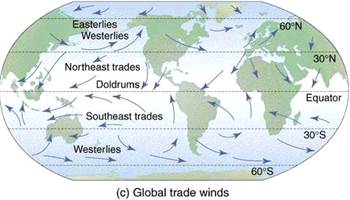
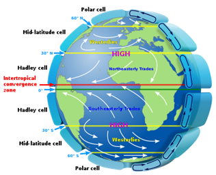
The trade winds or easterlies are the permanent east-to-west prevailing winds that flow in the Earth's equatorial region (between 30°N and 30°S latitudes).
Convection is the process generally associated with warm rising air and the formation of cloud.
ENSO Mechanism
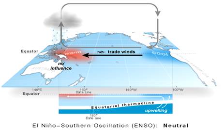
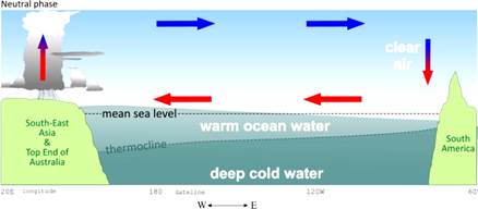
The 'Neutral phase'
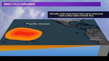
- Under ‘normal’ conditions, we have a situation referred to as a Neutral phase.
- At first, Easterly Trade Winds (blowing from east to west) push the warm surface water away from South America towards tropical South-East Asia.
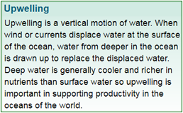
- Conversely, off the west coast of South America the depth of the warm equatorial top layer of the ocean has reduced, and the thermocline is nearer the ocean surface. This means that cold, nutrient-rich water upwells into the upper parts of the ocean here.
- Around tropical South-East Asia, warm surface water evaporates.
- Thiscauses increased rainfall around Indonesia and neighbouring lands such as the Top end of Australia.
- In contrast, over the eastern tropical Pacific and off the coast of Peru, dry air accompanied with cloud dissipation sinks, resulting in much drier weather there.
Note: The pattern of air rising in the west and falling in the east with westward moving air at the surface is referred to as the Walker Circulation.
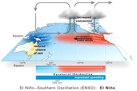
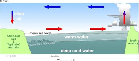
El Niño phase
- The Trade Winds loses most of their strength in an El Niño phase, and may even reverse into a westerly wind (west to east) direction.
- As a result, warm surface water from tropical South-East Asiaflows towards the coast of South America.
- Off the coast of South America, the thermocline sinks. The cold deep water no longer upwells into the surface layer of the ocean.
- The source of nutrients is cut off, which has a subsequent effect on fishing stocks off South America.
- Nearby, over the eastern tropical Pacific, warm surface water evaporates. This results in more rainfall than usual there.
- Conversely, on the other side of the Pacific, Indonesia and neighbouring countries are drier than usual during an El Niño.
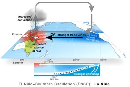
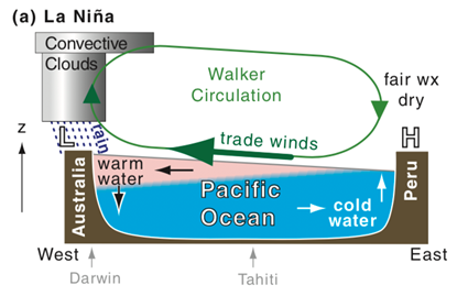
La Niña Phase
- In this pattern, trade winds blow warm water at the ocean’s surface from South America to Indonesia.
- As the warm water moves west, cold water from the deep rises to the surface near the coast of South America.
- Since, La Niña blows all of this warm water to the western Pacific places like Indonesia and Australia get much more convectional rain than usual.
- However, the cold water in the eastern Pacific causes less rain clouds to form there. So, places like the southwestern United States are much drier than usual.
- La Nina can also lead to more lightning activity within the Gulf of Mexico and along the Gulf Coast.
- And more tropical cyclones—which include hurricanes—forming in the deep tropics (near the islands in the Caribbean, for example).
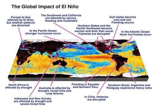
- In a nutshell, La Nina causes drought in the South American countries of Peru and Ecuador, heavy floods in Australia, high temperatures in Western Pacific, Indian Ocean, off the Somalian coast and a comparatively better monsoon rains in India.

Impact of La Niña
ENSO and India
|
|
El Nino and La Nina impact India greatly.
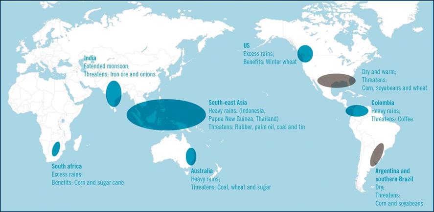
El Nino during winter causes warm conditions over the Indian subcontinent and during summer, it leads to dry conditions and deficient monsoon. Whereas, La Nina results in better than normal monsoons in India.
India experienced deficient rainfall during El Nino years 2002 and 2009 whereas monsoon was normal during El Nino years 1994 and 1997. It means that in about 50 per cent of the year with El Nino during summer, India experienced droughts during monsoon.
Crops like Paddy, Maize, Groundnut, Guar, Castor, Tur, Moong and Bajra suffer due to El Nino.
|
https://www.downtoearth.org.in/news/climate-change/rare-3rd-consecutive-la-nina-event-may-be-underway-the-first-in-70-years-84572


